
DNCC, DSCC, SCC
URP GIS - Urban Resilience & Emergency Management Platform
Project Overview
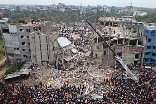
URP GIS is an advanced, city-scale GIS solution that strengthens urban resilience and emergency preparedness by combining real‑time incident management, dynamic mapping, and infrastructure oversight in a single platform. Cities use it to make faster, data‑driven decisions, streamline response, and optimize resources, reducing costs while improving public safety.
Deployed in Dhaka and Sylhet, URP GIS has transformed day‑to‑day urban management and disaster readiness through actionable insights, seamless collaboration across teams, and scalable, future‑proof technology.

Core Capabilities
Incident Management
- Centralized tools to monitor, log, and manage emergencies in real time.
- Automated alerts for floods, fires, and other critical hazards to accelerate response.
Mapping & Spatial Tools
- Interactive maps with distance measurement, radius search, and bounding‑box analysis.
- Multi-layered spatial data for deeper analysis and decision support.
Infrastructure Oversight
- Readiness mapping of fire stations, water sources, evacuation centers, and equipment depots to ensure rapid deployment and safe routing.
Mobile & Web Access
- Real‑time collaboration for field teams and planners across devices, with seamless data and GIS layer updates anytime, anywhere.
Why This Solution Stands Out
- Actionable Insights: Real-time data for swift, data‑driven decision-making during emergencies.
- Resource Precision: Deploy the right assets at the right time to minimize delays and maximize impact.
- Cost Optimization: Reduce operational inefficiencies and unnecessary expenditures.
- Seamless Collaboration: Strengthen communication across teams and stakeholders.
- Future‑Proof Technology: Scalable, customizable features that adapt to evolving urban needs.

Implementation Highlights (Dhaka & Sylhet)
- Proven Success: URP GIS deployments in Dhaka and Sylhet enhanced urban management and disaster preparedness, building confidence in the platform’s reliability and effectiveness.
- End‑to‑End Enablement: Tailored modules, 24/7 availability, and dedicated training ensure uninterrupted operations and rapid adoption.
- Security & Compliance: ISO‑certified data protection safeguards sensitive operational information.
Typical Use Cases
- Real‑time incident logging and alerting during flood and fire events.
- Spatial analysis to identify high‑risk areas and optimize evacuation zones.
- Asset readiness and coverage check for fire stations, water sources, and equipment depots.
- Cross‑team coordination with synchronized updates between field and command centers.
Support & Delivery
- Comprehensive Support: 24/7 assistance for continuous operations.
- Dedicated Training: Personalized onboarding to maximize system efficiency.
- Custom‑Fit Solutions: Modules tailored to the needs of cities and organizations.

