.jpg&w=3840&q=90)
Spatial Platforms Built for Production Scale
From transport analytics and environmental monitoring to national infrastructure systems - Streams Tech engineers GIS platforms that perform at real-world scale, backed by a decade of PostGIS, GeoServer, and full-stack spatial delivery.
.png&w=3840&q=75)
15+
GIS platforms deployed across Bangladesh, Zambia & the United States
.png&w=3840&q=75)
3
City corporations covered under World Bank Urban Resilience Project
.png&w=3840&q=75)
10yr
Building with PostGIS, GeoServer, and the open-source GIS stack

60K+
GPS-tracked spatial data points collected in the field
Built for
Full-Spectrum GIS Engineering
We cover the complete delivery chain - from field data collection and geodatabase design through to production-grade web and mobile GIS applications.

GIS Application Development
Custom web and mobile GIS platforms - from new builds to extending existing spatial products. Interactive map dashboards, offline-capable field apps, multi-role access control, and large dataset handling. We work equally in greenfield builds and inside established codebases.
.png&w=3840&q=75)
Spatial Data Management
Geodatabase design, schema optimization, and data pipeline development for complex spatial datasets. We handle raster, vector, and tabular formats with robust QA/QC workflows - including pan-city survey data covering tens of thousands of buildings.
.png&w=3840&q=75)
Mapping & Visualization
Dynamic map layers with thematic styling, heatmaps, choropleths, and spatial clustering for pattern detection. Integrated BI dashboards with real-time GIS feeds for planning, monitoring, and operational decision-making workflows.

Remote Sensing & Satellite Imagery
ML-based change detection and classification on satellite imagery. Land-use analysis, vegetation indices, water body mapping, and hotspot analysis. Proven with Sentinel-2 at national scale - monthly freshwater maps across all of South Africa.
.png&w=3840&q=75)
GIS Integration & APIs
RESTful GIS API design and integration with third-party platforms, enterprise systems, and external data registries. We handle authentication, data synchronization, and interoperability between GIS and non-GIS systems - including national data center deployments and cloud infrastructure.
.png&w=3840&q=75)
Field GIS Surveys & Data Collection
End-to-end field GIS survey execution - form design, enumerator training, GPS-based data collection, QA/QC, and integration into spatial databases. Proven at city scale: 33,000+ buildings and infrastructure assets digitally mapped and georeferenced across a single engagement.
Deployed at Real Scale
Named clients. Named systems. Running in production - not in a demo environment.

Government of BangladeshLGED GIS Unit
National Road Network GIS Planning Portal
Web-based GIS portal for the Local Government Engineering Department - Bangladesh's largest engineering agency - powering planning, prioritization, and monitoring of the national rural road network. Spatial analysis for road condition assessment, investment ranking, duplication detection, population coverage estimation, and automated map and report generation.
.webp&w=3840&q=75)
World BankUrban Resilience Project
GIS Asset Management Across 3 City Corporations
Comprehensive web-based GIS asset management system for Dhaka North, Dhaka South, and Sylhet City Corporations. Ward-level mapping of roads, drainage, utilities, and emergency service points - with integrated BI dashboards for real-time asset monitoring, vulnerability hotspot analysis, and disaster risk reduction planning.
World BankBangladesh Computer Council
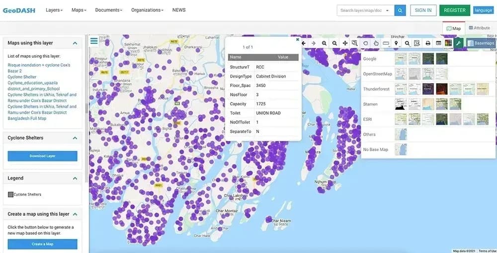
GeoDASH - National Open GIS Data Platform
Second-phase development of GeoDASH - the national geospatial open data sharing platform for the Government of Bangladesh. Enables secure multi-stakeholder GIS data management, map layer visualization, and controlled publishing for urban resilience and disaster risk planning. Full QA/QC, stakeholder training, and promotional materials delivered.
JICASurvey of Bangladesh
National Spatial Data Infrastructure (NSDI) Prototype
Built the NSDI Prototype System for the Government of Bangladesh - a national web-based GIS platform for secure geospatial data sharing, visualization, and multi-tier access control across government agencies and development partners. Included nationwide user training program for government staff and donor organizations.
GeoTerraImage (Pty) LtdSouth Africa
Sentinel-2 National Freshwater Monitoring Platform
Cloud-based web platform using Sentinel-2 satellite imagery to generate monthly, nationwide freshwater surface maps across South Africa. ML-based change detection and water body classification, delivered through an interactive GIS dashboard. Enables cost-effective, data-driven water resource management at continental scale.
SNV NetherlandsGWSC / AIT Bangkok
IMIS - Multi-City GIS Asset Management Platform
GIS-integrated web and mobile platform managing real-time spatial data, asset registries, service scheduling, and analytics dashboards across 15+ cities in two countries. Full PostGIS/GeoServer backend, Android field apps with Mergin Maps integration, online payment modules, and national data center deployments. Built and maintained across multiple engagement phases over five years.
THE CITY OF CHARLOTTESVILLEVIRGINIA, USA
Development of A Web-Based Solar Map
Built an interactive ArcGIS web application mapping solar potential for Charlottesville buildings, enabling property owners to assess rooftop PV suitability and estimate environmental benefits. The platform calculates total roof area, usable space, system size, and potential energy savings to reduce utility bills and promote clean energy adoption. Features a user-friendly map viewer interface with detailed property-level insights.
THE TOWN OF PURCELLVILLEVIRGINIA, USA
Development of Online Adopt-A-Hydrant Platform
Built an interactive, map-based platform for Purcellville's Adopt-a-Hydrant program, enabling residents to adopt local fire hydrants and keep them clear of snow during winter storms. The system allows citizens to view available hydrants, sign up, and name their adopted hydrants, while providing town staff with administrative tools to manage volunteers, track signups, and coordinate cleanup reminders for community safety.

Production GIS Stack
We work across the full open-source and proprietary GIS ecosystem - selecting the right tool for each layer of your platform, not defaulting to a single vendor.
Spatial Databases
- PostgreSQL / PostGIS
- pgRouting
- SQL Server Spatial
- SpatiaLite
GIS Servers & Tile Services
- GeoServer
- MapServer
- GeoNode
- WMS / WFS / WMTS
Desktop & Field GIS
- QGIS
- ArcGIS
- Mergin Maps
- QField
- ODK
Frontend Mapping
- OpenLayers
- Leaflet
- MapboxGL
- ArcGIS JS API
- Angular
Remote Sensing & Analysis
- Sentinel-2
- GDAL / OGR
- rasterio
- shapely
- fiona
Backend, Cloud & DevOps
- ASP.NET Core
- Laravel / PHP
- Docker
- AWS
- National Data Centers
Four Things That Actually Matter
Not the usual vendor promises - specific, verifiable reasons why experienced GIS buyers choose us.
Deployed at national scale, not just piloted
We've built GIS systems that manage national infrastructure. LGED's national rural road network, Bangladesh's NSDI, and the World Bank's Urban Resilience system across three city corporations are production systems serving thousands of government users - built and deployed by our team, not handed off to a systems integrator.
→ LGEDNSDI (JICA)GeoDASHWorld Bank URP
We own the full GIS delivery chain
From field survey design and enumerator training - Mergin Maps, QField, Android GPS apps - through geodatabase architecture in PostGIS and tile service configuration in GeoServer, to production web and mobile applications. We don't hand off the difficult parts to subcontractors. One team, end to end, with QA/QC documentation at every stage.
→ 33,000+ buildings mapped15+ citiesPan-city surveys executed by our team
Remote sensing and spatial ML, not just map viewers
Most GIS development firms stop at web mapping. We build the analytical layer too - satellite imagery pipelines, ML-based classification and change detection, and automated spatial analysis at national scale. Our Sentinel-2 platform generates monthly freshwater surface maps covering all of South Africa, running as a production system, not a research prototype.
→ Sentinel-2ML classificationGDAL/rasterio pipelinesNational-scale coverage
We embed in your team and your codebase
We work inside your existing platform, your workflow, and your delivery rhythm - not alongside it. Whether you're extending a spatial SaaS product, scaling to new markets, or shipping a complex new GIS feature, we integrate cleanly with your team. Post-delivery, we stay engaged: performance monitoring, feature iterations, and ongoing engineering support as needed.
→ 2–20 engineers availableOnboard in 1–2 weeksStaff aug or project-basedNDA & IP assignment standard

Have a GIS challenge? Let's map it out.
Talk to an engineer, not a salesperson - we typically onboard within 1-2 weeks.
.png&w=3840&q=75)