Engineering Bangladesh's National Geospatial Data Platform
How Streams Tech rebuilt and hardened GeoDASH - the Government of Bangladesh's national geospatial open data sharing platform - and delivered the system that later became the foundation for the country's National Spatial Data Infrastructure prototype.
Client
Bangladesh Computer Council | World Bank
Our Role
Full re-engineering of the national platform
Reach
25+ government & national organizations
Legacy
Foundation for Bangladesh's NSDI prototype
One Platform for a Nation's Spatial Data
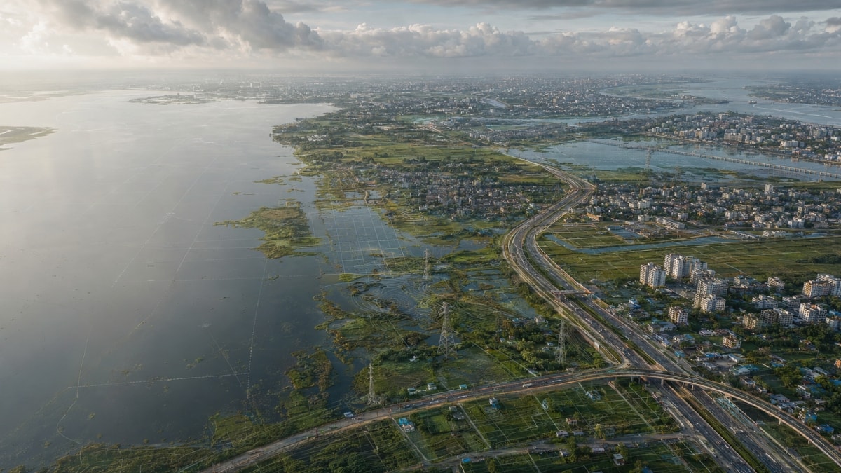
GeoDASH - the Geospatial Open Data Sharing platform was engineered as Bangladesh's national infrastructure for storing, managing, and sharing geospatial data across government agencies, private organizations, and the public. Originally initiated under the World Bank's disaster risk management program for Greater Dhaka, the platform addressed a problem every large government faces: dozens of agencies each holding critical spatial data - road networks, utility lines, flood zones, building footprints - in isolated silos, invisible to each other precisely when coordination matters most.
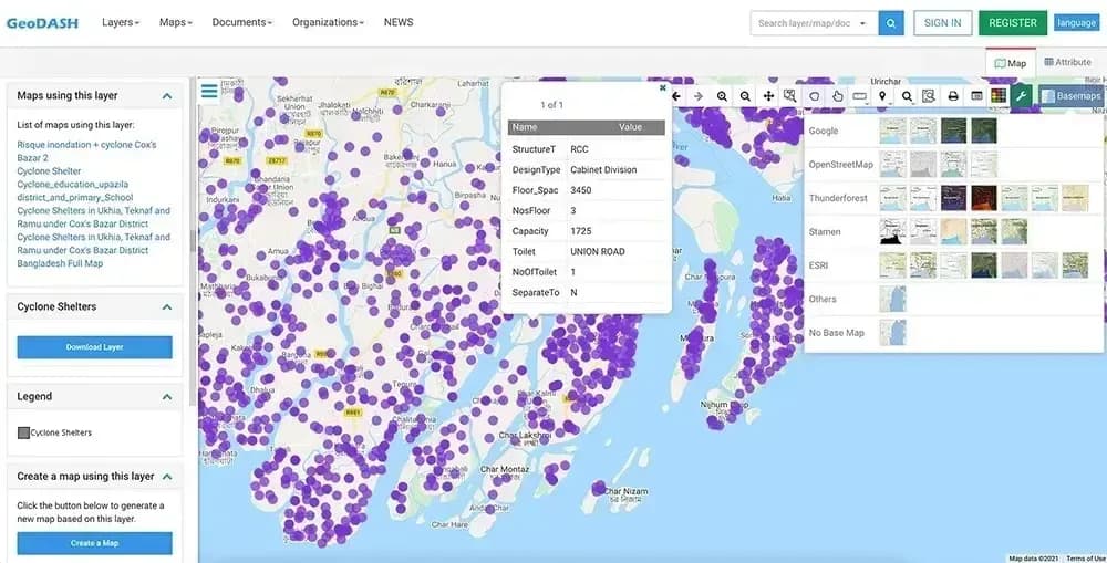
Built by deeply customizing the open-source GeoNode framework, GeoDASH gave each agency a secure workspace to publish map layers, control access, and consume data published by others - turning fragmented departmental GIS holdings into a shared national asset for planning and emergency response.
2014
GeoDASH roadmap published under the World Bank / GFDRR-supported urban resilience program; beta platform launched with a data-sharing working group of 11 government agencies.
2015
Platform ownership transferred from the World Bank to the Bangladesh Computer Council (BCC), ICT Division - making GeoDASH a permanent national system.
2017–2018
Streams TechStreams Tech engineered Phase 2 - a full functional and security enhancement of the platform: deeply customizing the GeoNode core, resolving critical defects, building new capabilities, and redeploying the hardened system to production.
2017–2018
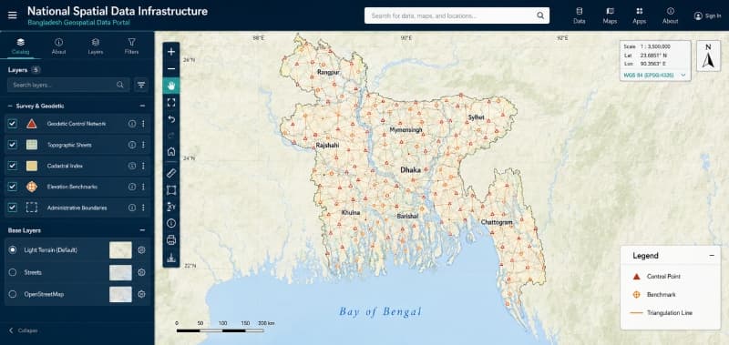
Streams TechThe NSDI Prototype was built over GeoDASH. Working with JICA and the Survey of Bangladesh, Streams Tech developed the country's National Spatial Data Infrastructure prototype on top of the GeoDASH foundation - extending our platform work into national SDI policy.
The Engineering Problems We Solved
Re-engineering open source into national infrastructure
GeoDASH is not stock GeoNode with a logo. We customized the open-source core far beyond its out-of-the-box capabilities - routing, elevation services, thematic analysis, a national API layer, e-service bus integration - while keeping the platform compatible with GeoNode's upstream release cycle. Deep customization without forking into a dead end is one of the hardest disciplines in open-source engineering, and it's the difference between a platform that lasts and one that can never be upgraded again.
02Taking over a live platform - without downtime
We inherited a first-phase codebase built by others, with critical defects limiting agency adoption. Our team re-engineered it while the platform stayed in service for government users - stabilizing, restructuring, and extending a system we didn't originally build.
03Multi-tenant security for inter-agency data
Dozens of agencies, one platform - each owning its data outright, each controlling exactly which layers are shared with whom. We hardened authentication, access control, and workspace isolation across government, private, and public user tiers.
04Content curation at national scale
A national catalog is only as trustworthy as its review process. We built a companion mobile app giving administrators real-time notifications and approve/reject workflows for every layer, map, and document uploaded - so curation keeps pace with contribution, from anywhere.
05From data sharing to operational analytics
We extended the platform beyond its cataloging role - building analysis capability over cell tower and Wi-Fi node location data to produce planning and monitoring reports, turning a data repository into a decision-support tool.
And the fundamentals, done properly: structured QA/QC across test and production cycles, national production deployment, complete system documentation, and stakeholder training across government agencies.
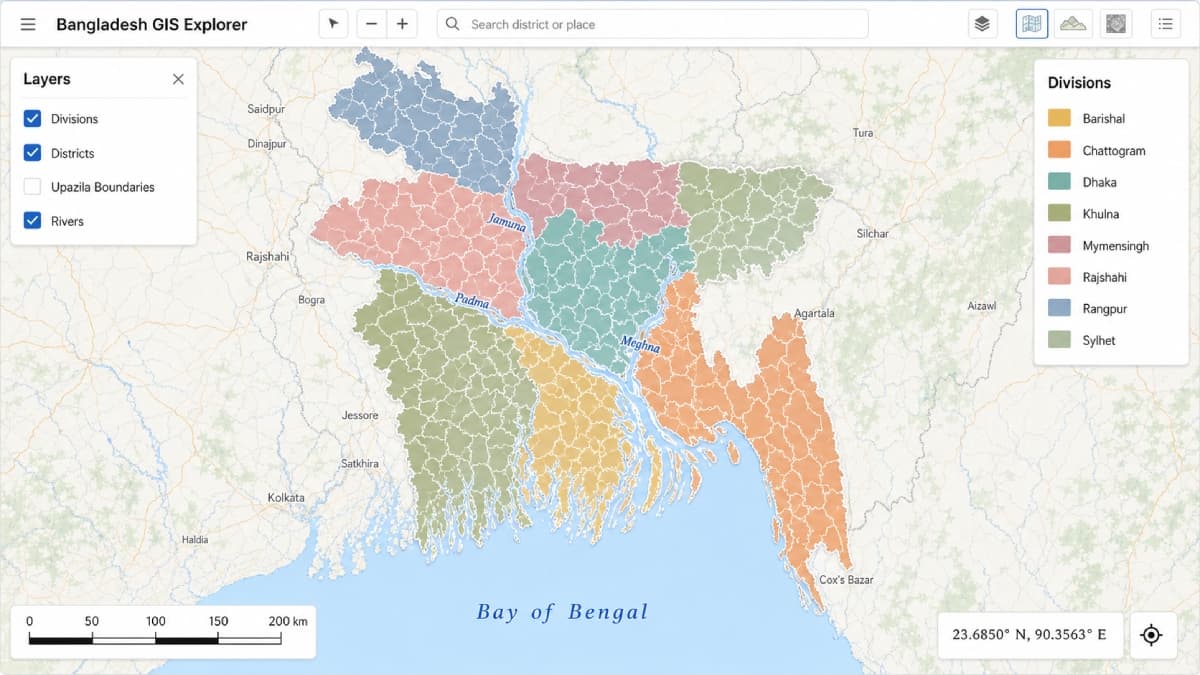
Interactive district boundaries across divisions of Bangladesh
.jpg&w=3840&q=75)
Dhaka WASA potable water utility network, Banani area
Capabilities Built Into the Platform
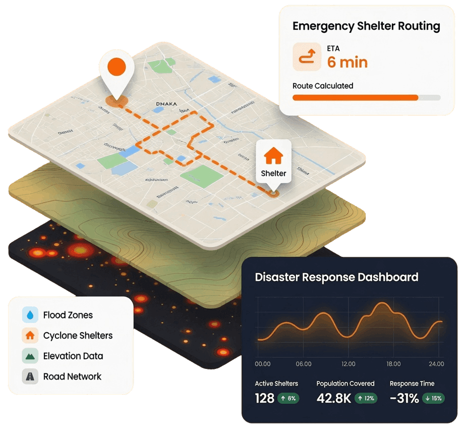
Emergency shelter routing
Turn-by-turn routing from a user's live location to the nearest shelter point - on web and mobile. GIS as life-safety infrastructure, not just a map viewer.
Point-anywhere elevation lookup
Click any location in Bangladesh and get instant elevation, served from national raster data - terrain intelligence embedded directly in the map interface.
Thematic mapping engine
Heatmaps, choropleth, and bubble visualizations for hotspot identification and density analysis - configurable by users on their own layers.
Two-way address ↔ coordinate conversion
Convert addresses to geographic coordinates and back, with results saved directly as reusable map layers.
In-browser layer styling
QGIS-grade styling controls in the browser - users restyle shared layers for their own maps without ever altering the source data or its permissions.
Upload validation & projection handling
Automatic dataset validation on upload with guided error correction, and on-the-fly conversion of arbitrary projections to WGS84.
40-50 public REST APIs
A full third-party integration surface, compliant with the Bangladesh National Enterprise Architecture and the national e-service bus (WSO2) - so other government systems consume GeoDASH data programmatically.
OSM ingestion & OGC tooling
OpenStreetMap data loaded via Overpass integration, and OGC-compliant layers consumable directly in QGIS, ArcGIS, and other GeoNode instances.
Print engine to A1 at 300 dpi
Production-quality map printing with basemaps, data tables, and charts - up to A1 format, including multi-map booklet generation.
Map usage analytics
Pan, zoom, click, and time-on-map telemetry alongside layer-load and visitor metrics - giving administrators visibility into how the national catalog is actually used.

Platform Stack
GeoDASH was adopted by agencies across the Government of Bangladesh for sharing disaster-risk and infrastructure data - and the platform Streams Tech re-engineered became the foundation on which the country's NSDI prototype was built. When a government trusts you with its national spatial data layer twice, that's the reference.
More National-Scale GIS Platforms
National Spatial Data Infrastructure Prototype
National Road Network GIS Planning Portal
View project
GIS Asset Management Across 3 City Corporations
View project
Ready to Build the Next Generation of National GIS Infrastructure?
GIS infrastructure governments can depend on - built to GeoDASH's national scale and security standards.